Geo location rank tracking means checking where your business ranks on Google when the search is made from a specific place: a city, a ZIP code or an exact GPS point. It is geographic. It has nothing to do with generative engine optimization, the other "GEO". If you want to know whether ChatGPT or Gemini names your business, that is the job of the AI visibility tracker; this post is about the map.
The method you pick decides what you see. A city-level check gives you one number per city. A ZIP-code check gives you one number per postal area. A GPS grid gives you one number per pin, and it is the only version that shows a business at position 2 next to the shop and position 20 three miles away.
What geo location rank tracking is and what it measures
In practice you record your rank from a chosen point on the map, then repeat the search from other points. What that measures is Google's distance factor.
Google's local results are ranked on three factors. In its help page on local ranking, Google defines them as relevance, distance and prominence, and describes distance as "how far each business is from the customer who's searching". The same page adds that "if a customer doesn't share where they are, Google uses what it knows about their location". So every rank you record is tied to the point Google thinks the searcher is standing on.
Google works that point out from several sources. Its page on location in Search lists device location ("phones, computers, watches, or wearable devices, can work out their precise location"), the IP address, home and work addresses saved in the account, and areas you searched for in the past. It also draws a line between a "general area", which it defines as larger than 3 sq km with at least 1,000 users, and a "precise location" used when you grant the permission. Because phones report that precise location, mobile rank tracking needs a set location as well as a device.
That is why a plain rank check tells you very little: the number you get is the number for your desk. A geo location rank tracker sets the searcher location on purpose, records the result, and repeats that for as many locations as you ask. How finely it lets you set that location is what separates the three methods.
Important: a rank without a location is not a rank. When someone says "we are number 3 for emergency plumber", the honest reply is "from where?". The post on why Google Maps rankings change by location walks through the five variables behind a single search if you want the full mechanism.
The three resolutions: city, ZIP code and GPS grid
Every geo location rank tracker resolves the searcher location at one of three levels. The table shows what the tool sets, what you get back and where each one goes blind.
| Method | What the tool sets | Results per keyword | Best for | Blind spot |
|---|---|---|---|---|
| City level | One point somewhere in the city, chosen by the tool | 1 per city | Regional or national sites, one-off checks | Everything that changes inside the city |
| ZIP code level | One point per postal code, chosen by the tool | 1 per ZIP | Comparing neighborhoods at a glance | ZIP shapes and sizes vary; still a single point |
| GPS grid | Latitude and longitude of every pin, at a spacing you choose | 1 per pin (9 to 1,000) | Local pack and Maps rankings for one business or service area | Costs one credit per pin per keyword |
City-level tracking
City-level tools ask you for a place name and run the search as if you were at one point in that city. ProRankTracker's own guide to geo location rank tracking describes the setup as "type in your location, then select from the dropdown menu", and you can assign several locations to one keyword. The article never says which coordinates the dropdown maps to, so two tools can disagree on the same city without either being wrong.
For a one-off check you don't need a subscription at all. The free Google search UULE generator builds a google.com/search URL with the location encoded in the uule parameter; it covers "any city in the world", with 115k locations indexed, and allows 3 generations a day without an email. Paste the URL in a private window and you see the results Google serves at that city's point. It's one keyword and one location at a time, which is fine for spot checks and useless for a weekly report.
City level is the right resolution when the thing you rank is a website in organic results and the audience is a whole region. It's the wrong resolution for a local pack, because the pack changes within a mile.
ZIP-code-level tracking
ZIP-level tracking feels more precise than it is. The US Census Bureau explains that the USPS assigns ZIP Codes "to delivery routes", each one "composed of street networks, and/or individual units with high mail volumes". A ZIP code is a set of routes, not an area. The Census Bureau builds its own polygons, called ZCTAs, as "generalized areal representations" of those point-based codes. So when a tool says it tracks a ZIP, it has picked a single point somewhere inside a shape that the postal service never drew.
Which point is the tool's choice. A rural ZIP can be 20 miles across; a dense urban ZIP can be a few blocks. One rank per ZIP is a useful summary for comparing neighborhoods, and it's a step up from one rank per city. It still hides the drop-off between the point the tool picked and the edge of the postal area.
GPS grid tracking
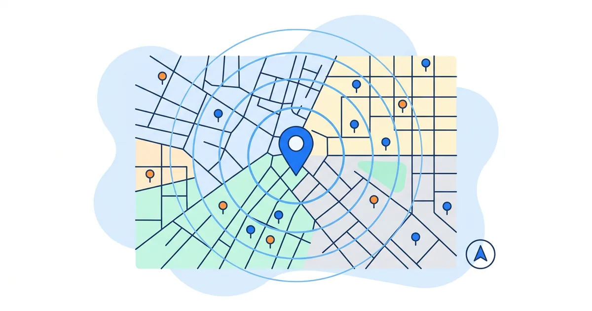
A GPS grid tracker sets the exact latitude and longitude for every search. Whitespark describes its version as tracking "based on geo-coordinates (latitude and longitude) instead of zip code areas" in its help article on coordinate searches. GTrack does the same for every pin on a grid: the new scan tutorial has you pick kilometers or miles, a spacing from a "distance dropdown (for example 1 km)" and a grid size such as 9x9, or draw a rectangle, circle or polygon on the map. Each pin becomes one search from those coordinates, and the result is a heatmap: "green numbers mean strong rankings" and "orange numbers show weaker visibility further from your location". To check that a tracker's pins match what Google shows, use the five-minute test in our guide to which local rank tracker is most accurate.
The grid is the only method that measures the thing Google actually ranks on, distance from the searcher, at the resolution Google uses. If the grid itself is new to you, start with what a Google Maps grid rank tracker is, which covers the grid concept and how each point is tested.
Where each method lies
Take a made-up plumber with a shop near the city center and a service area that runs 8 miles east. The numbers below are invented to show the mechanism, not measured. The three methods report three different businesses.
- City level says you're winning. In this made-up example the tool's city point sits half a mile from the shop. Distance is minimal, so the plumber ranks 2nd. The report is green and nobody looks further.
- ZIP level says you're fine. Four ZIP codes across the service area return positions 2, 5, 9 and 14. The average is 7.5, which reads as "page one". The point in the fourth ZIP happened to be on its western edge, closest to the shop.
- The grid says you have a problem. A 7x7 grid at 1-mile spacing returns 49 ranks and reaches 3 miles each way, enough to see the pattern. The 9 pins nearest the shop show 1 to 4. The 21 pins on the east half, where most of the jobs are, show 15 to 20+. The customer who searched from there never saw the plumber.
None of the three tools is wrong. Each answered the question it was asked, and only the grid asked "how do we rank across the area we serve?", which is how a customer finds a plumber.
Averages hide the spread, too. An average rank of 7 could be "7 everywhere" or "1 near the shop, 13 everywhere else". The post on reading a Google Maps heatmap decodes the five patterns that a single number can't show.
How to run a geo location rank scan, step by step
These are the steps from the GTrack new scan tutorial linked above; most grid tools follow the same order with different option names.
- Pick the business. Search for it by name and select it from the results. Service-area businesses and profiles with a hidden address are supported; the scan centers on the profile's location.
- Add keywords. Up to 5 per scan, typed one at a time. Use the phrases customers type ("emergency plumber", "boiler repair"), not your company name. On paid plans an AI suggestion feature proposes up to 20 keywords.
- Choose the surface. Maps Scan, Local Pack Scan, or Both. The 3-pack in Google Search and the Maps results are two different lists; Both is the honest default.
- Set the area. Preset grid mode gives a square grid (3x3 up to 13x13). Draw mode lets you draw a rectangle, a circle or a freeform polygon, which is what you want when a river, a coast or a highway cuts your service area.
- Set units and spacing. Kilometers or miles, then the distance between pins from the dropdown. Spacing times grid width is your coverage: 7 pins at 1 mile cover a 6-mile line.
- Advanced settings (Advanced plan and up). Zoom level and search language.
- Run the scan and read it. Each pin shows a rank, green for strong positions and orange for weak ones. The summary shows your average rank across every grid point and which competitors appear in the top 20.
Every pin costs one credit per keyword. The GTrack product page states it as "one credit per scan point per keyword", so a 3x3 scan for one keyword costs 9 credits. The table shows how that scales over a weekly schedule.
| Grid | Pins | 1 keyword, 1 scan | 3 keywords, 1 scan | 3 keywords, weekly (4 scans) |
|---|---|---|---|---|
| 3x3 | 9 | 9 credits | 27 credits | 108 credits |
| 5x5 | 25 | 25 credits | 75 credits | 300 credits |
| 7x7 | 49 | 49 credits | 147 credits | 588 credits |
| 9x9 | 81 | 81 credits | 243 credits | 972 credits |
| 13x13 | 169 | 169 credits | 507 credits | 2,028 credits |
Against the plans on the product page (Free 200 credits a month, Starter 5,000, Advanced 15,000, Business 36,000, Pro 81,000), a 5x5 grid with 3 keywords fits inside Starter at a weekly cadence with room for a second location, and the Free plan's 200 credits cover eight 5x5 scans with one keyword a month.
Tip: run the first scan with one keyword and a 5x5 grid. It costs 25 credits and tells you whether the problem is everywhere (fix the profile) or on one side of town (fix distance-related signals like service areas and location mentions). Add keywords once you know which side of the map you're working on.
Grid size, spacing and cadence
The wrong grid wastes credits or hides the drop-off. Match the spacing to how far customers travel to you, or you to them. The grid rank tracker post linked above has the sizing table per business type, so here is the short version: 5x5 at 0.2 miles for restaurants, dentists and salons, 7x7 at 0.5 miles for plumbers, HVAC and locksmiths with a defined city radius, 9x9 or 11x11 at 1 mile for chains and regional service businesses.
What that post doesn't cover is the credit side. Each step up in grid size roughly doubles the bill per keyword: 25 credits for a 5x5, 49 for a 7x7, 81 for a 9x9, 121 for an 11x11. Pick the smallest grid whose corners still sit inside your catchment. If the area isn't square, draw mode with a polygon follows your actual coverage and stops paying for pins over the sea. For multi-location brands, the multi-location rank tracker playbook covers the location list, radius per store tier and the brand-level KPIs, so it isn't repeated here.
Cadence is the other lever. Scheduled scans run "daily, every other day, weekly, every 2, 3, or 4 weeks, or monthly" according to the product page; the scheduled scans tutorial lists up to 3 keywords per schedule on Free and 5 on Starter, and shows the results on a scrollable timeline where you pick any date and compare. Weekly is enough for most single-location businesses; daily is for the weeks right after a profile change or a suspected drop. The post on how often to track Google Maps rankings gives the reasoning per situation.
Geo rank tracking for agencies and competitors
The same grid answers a second question: who is winning the pins you lose? The product page lists competitor tracking at 1 competitor on Free, 10 on Starter, 25 on Advanced, 50 on Business and 100 on Pro. Each tracked competitor shows up on the same grid, so "we dropped on the east side" turns into "we dropped on the east side and this specific competitor took those pins".
For client reporting, every plan, including Free, generates public report URLs that a client can open without a login; Business and Pro serve them from a white-label domain and add API and MCP access. If you run scans for several clients, the Google Maps rank tracker playbook for agencies covers credit budgeting and reporting cadence across accounts. If you're comparing GTrack with a tool that has "geo" in its name, the GeoRanker alternative page puts the two side by side.
What to do next
Match the resolution to the question. A city-level or UULE check for "what does a searcher in that city see". A ZIP-level number to compare neighborhoods. A GPS grid the moment the question is "where do we lose customers", which for a local business is every time.
You can run the grid version right now without a subscription. The Google Maps rank tracker page states that "your first scan is free, no account needed". After that, the Free plan is $0 with 200 credits a month, grids up to 5x5, 1 tracked competitor and public report links. Draw mode starts on Starter ($19.99 a month), and a schedule grows from 3 keywords on Free to 5 on Starter. Custom zoom and language and teammates start on Advanced ($29.99). API and MCP access and the white-label domain are on Business ($59.99) and Pro ($99.99). Paid plans allow custom grids up to 1,000 points and carry a 30-day money-back guarantee.
The scan tells you where the gap is. Closing it means changing the profile: categories, services, photos, posts and review replies that mention the areas where you rank poorly. GTrack only measures; for the fixing side, the Google Business Profile management software handles review replies, scheduled posts and monthly reports for every location from one dashboard. Rescan 7 days after each change and compare on the timeline.
GTrack: one 5x5 scan for your main keyword costs 25 credits, so the free 200 credits a month buy a scan every week of your most important phrase, on a schedule so you never forget it, with credits left over for a second keyword twice a month.
Frequently Asked Questions
What is geo location rank tracking?
Geo location rank tracking is checking your Google ranking for a keyword from a chosen geographic point rather than from your own device. Google ranks local results partly on distance from the searcher, so the same keyword returns different results in different places. A tracker sets that location on purpose, at city, ZIP code or GPS coordinate level, and records the rank at each one.
Is a geo rank tracker the same as a GEO (generative engine) tracker?
No. A geo rank tracker measures Google Search and Google Maps rankings by geographic location. A GEO or AI visibility tracker measures whether AI assistants such as ChatGPT, Perplexity, Gemini and Google AI Mode name your business in their answers. Search results for "geo rank tracker" mix the two meanings, so check which one a tool page describes.
Can I track Google rankings by ZIP code?
Yes, and many tools offer it, but a ZIP code is not an area. The US Census Bureau describes ZIP Codes as sets of mail delivery routes, so a tool that tracks "by ZIP" picks one point inside the postal area and searches from there. One rank per ZIP is a fair summary for comparing neighborhoods. For a local pack, where results change within a mile, a GPS grid with pins at a spacing you choose is more accurate.
How many grid points do I need?
Enough to cover the area your customers come from, at a spacing that matches how far they travel. A walk-in storefront is usually well served by a 5x5 grid at 0.2-mile spacing (25 points). A service-area business with a defined city radius needs a 7x7 at 0.5 miles (49 points); a regional one needs a 9x9 at 1 mile (81 points) or a drawn polygon. Every point costs one credit per keyword, so a 5x5 scan with one keyword is 25 credits.
How often should I run a geo location rank scan?
Weekly is enough for most single-location businesses; it catches a drop within days and builds a comparable history. Run daily for the two weeks after a profile change or when you suspect a suspension or a drop. Monthly is fine for a stable business that only needs a record. Scheduled scans in GTrack run at any interval from daily to monthly, with up to 3 keywords per schedule on the Free plan.
Is there a free geo location rank tracker?
Yes. GTrack runs the first grid scan free with no account, and its Free plan gives 200 credits a month for grids up to 5x5 with one tracked competitor and public report links. For a single city-level check with no tool at all, the free Google search UULE generator builds a Google URL that returns results as if you searched from that city.